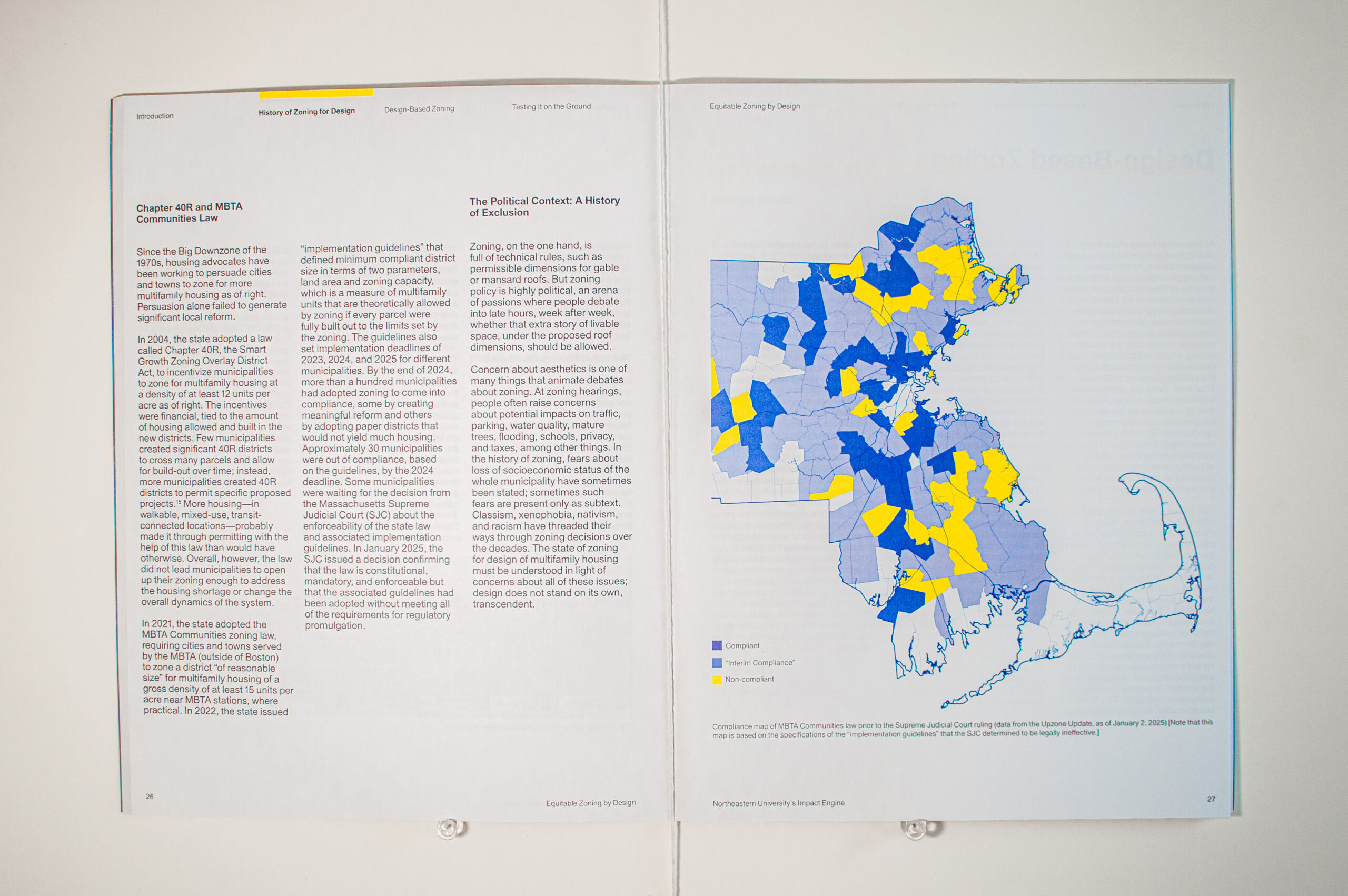
Equitable Zoning by Design
Description
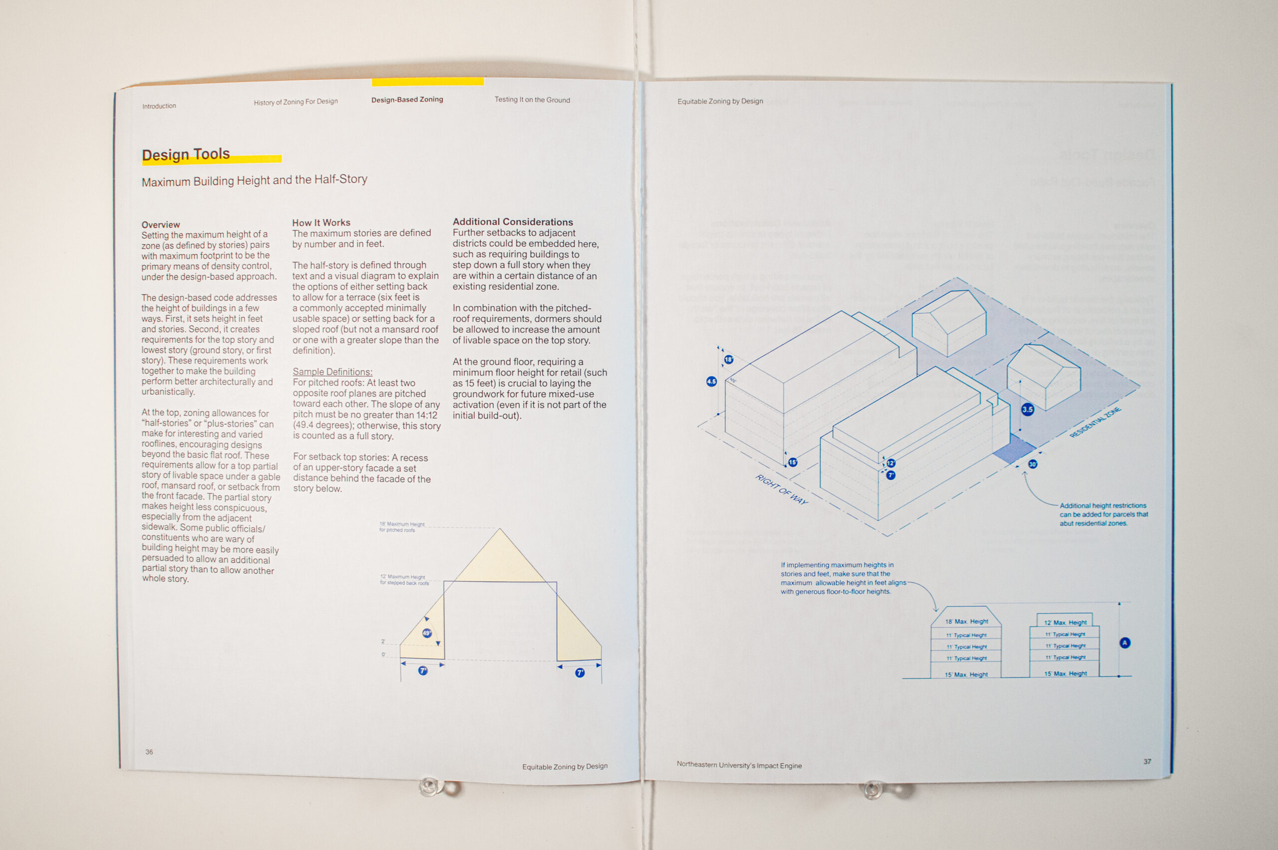
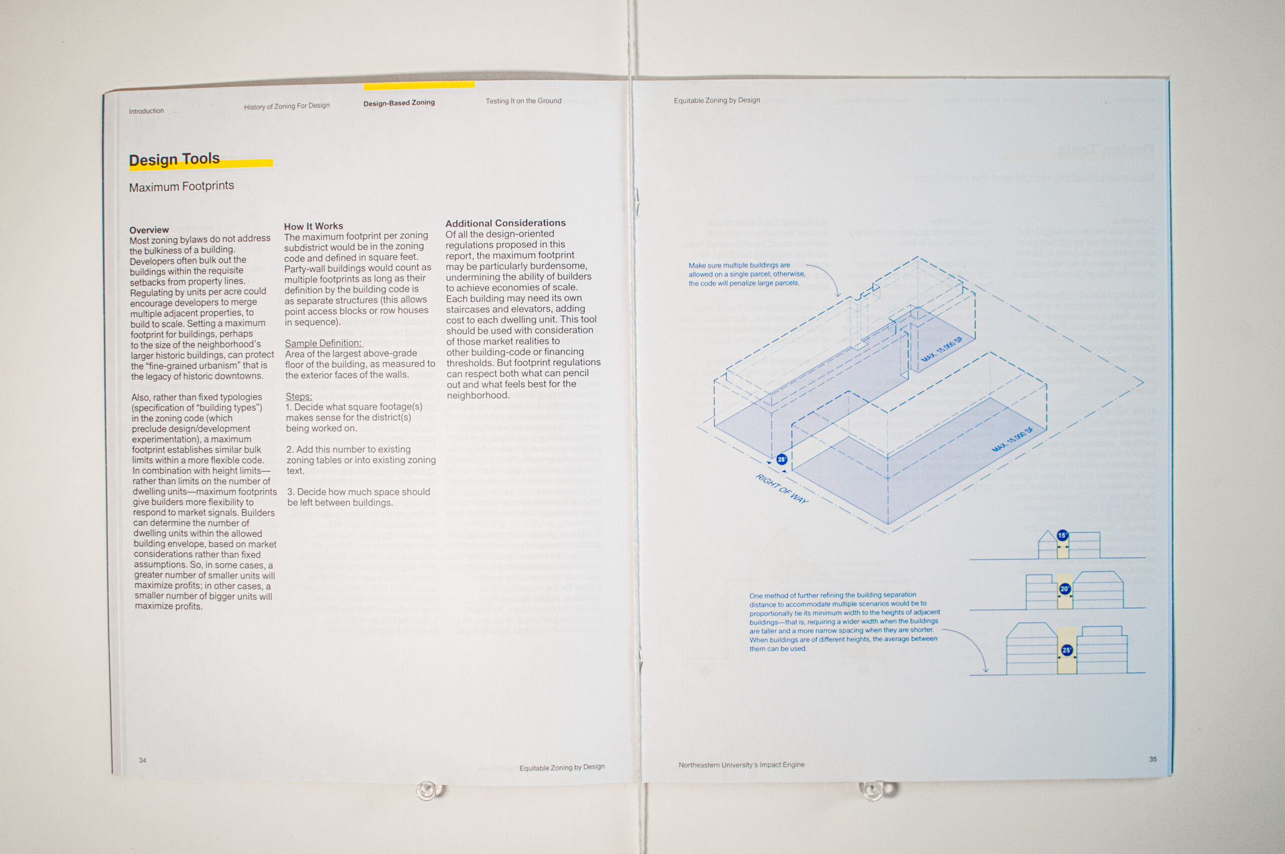
Equitable Zoning by Design is a report which explores the role of design thinking in much needed zoning reform in Massachusetts. The report highlights the spatial implications of outdated zoning regimes in Massachusetts, especially in transit-oriented and walkable mixed-use hubs,and suggests several design-based zoning alternatives. These suggested zoning tools are different in scope and ideological intent than those in a more comprehensive form-based zoning regime. The design-based zoning toolkit establishes the size and shape of buildings by prescribing the maximum building footprint, maximum number of stories, and optional solutions for the roof form.
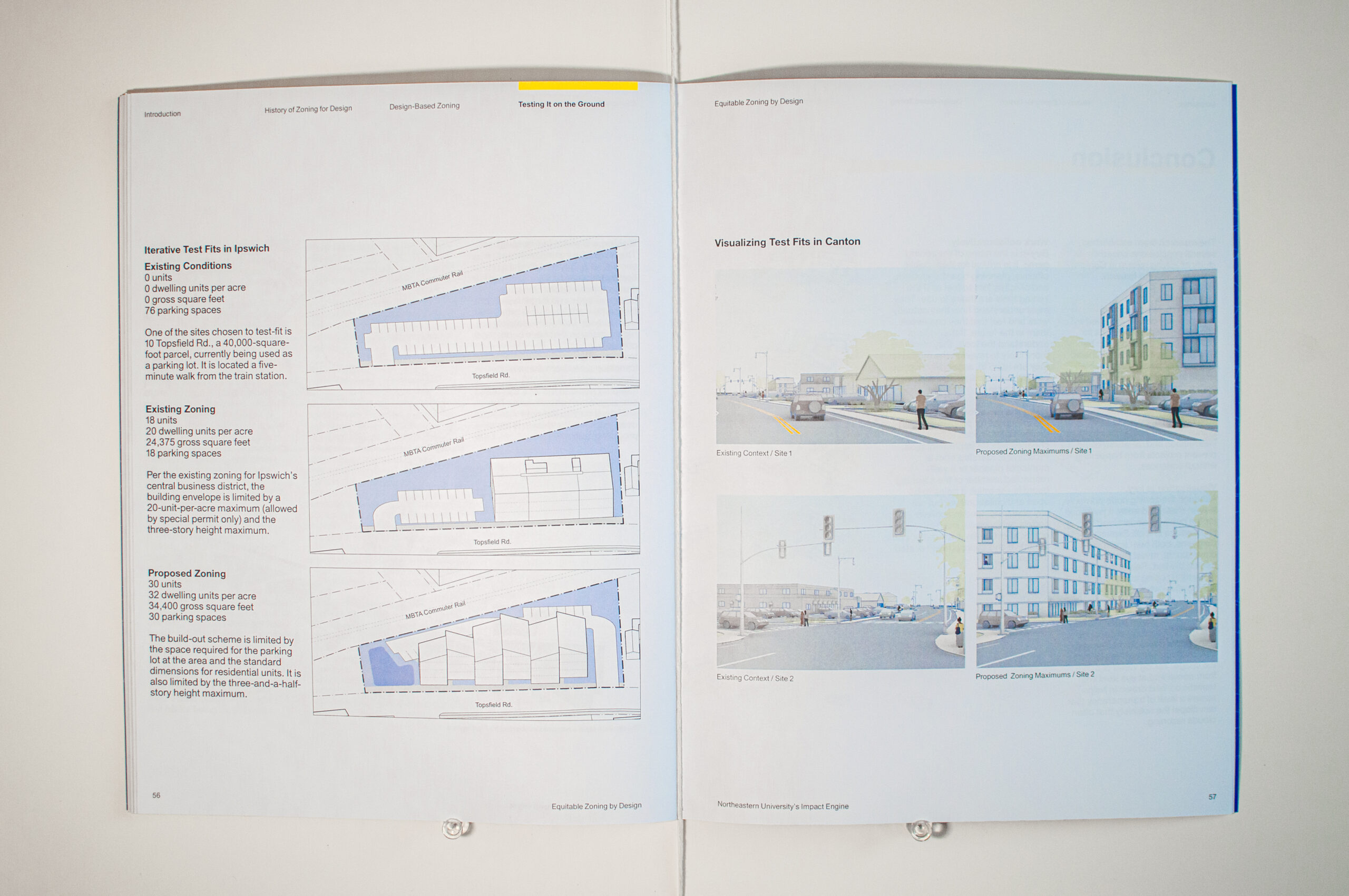
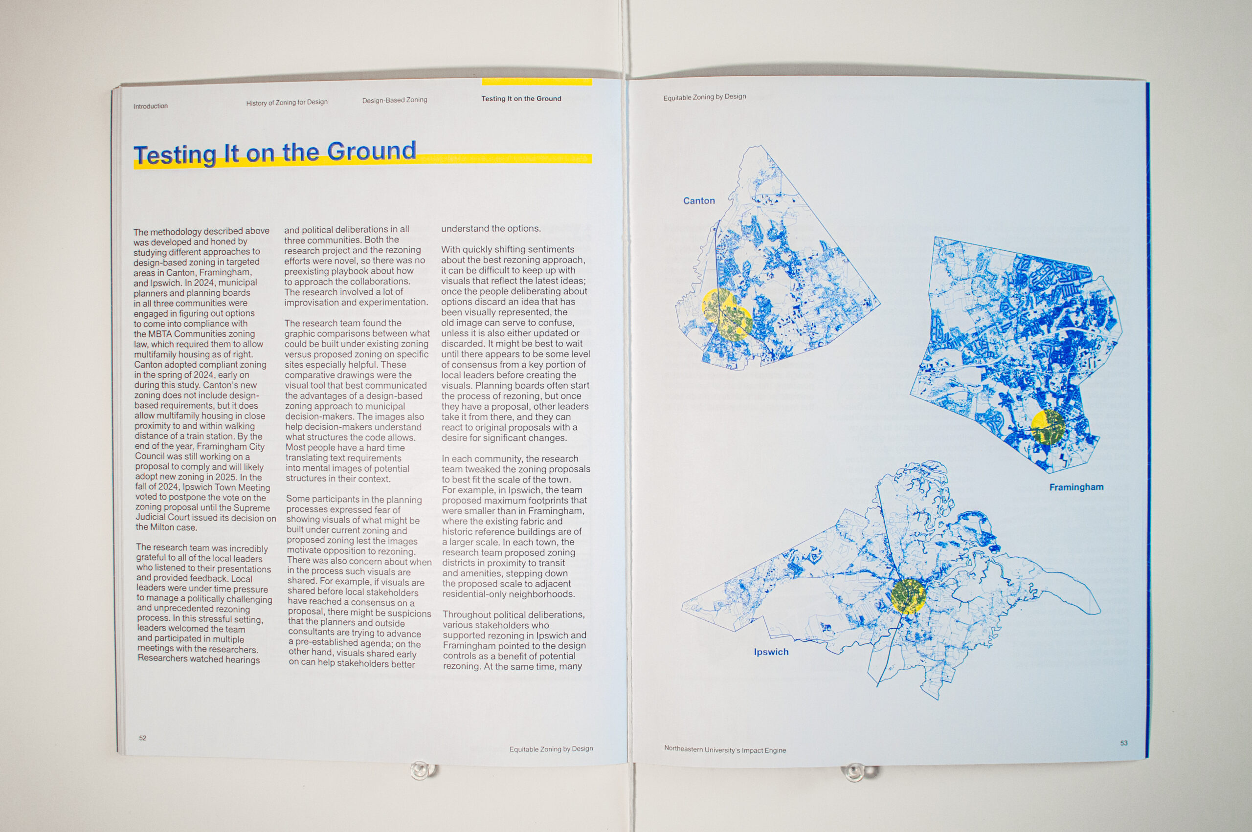
The team’s collaboration with the municipalities of Canton, Framingham, and Ipswich, all required to reform their zoning within the same time period, provided the opportunity to test some of the zoning tools in real time.The team acted as advisors, using eye-level perspective drawings to visualize the built outcomes of a municipalities current zoning, as well as the potential built outcomes under a reformed zoning regime. Discussions with local officials and planning boards also gave the authors the opportunity to observe and compare the different hurdles that town planners face while attempting to reform zoning policy.
The report presents a set of easy-to-understand and enforce zoning tools which can be used by town planners and city officials to support predictable and desirable built-outcomes in their municipalities.
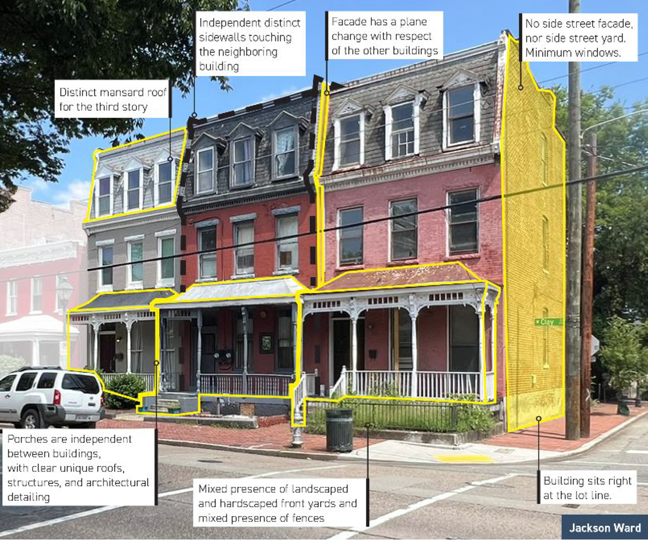
Equitable Zoning by Design highlights the role zoning has historically had as a barrier to multifamily housing production, and demonstrating how zoning reform can lead to more desirable and equitable built environments. The research approach centers actionable and realistic reforms, informed by town/city planners and community members.
The work models an interdisciplinary approach, with input from policy researchers, town officials, architects, and urban planners. The team worked to make complexities of zoning policy more accessible to the public by generating before and after perspectives of familiar parcels, Translating a town’s “total unit capacity” from a number into a potential streetscape.