Richmond Zoning Pattern Book
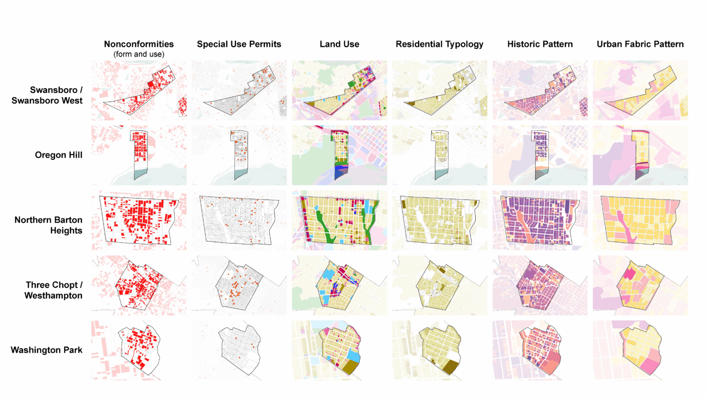
As part of Richmond’s zoning code update, Utile created the Richmond Pattern Book, an in-depth study of how the city’s traditional neighborhoods are built and why many don’t align with current zoning. The function of the pattern book is to inform the new zoning code and help ensure that it permits and encourages infill development that is compatible with the underlying neighborhood character. The analysis examined the most common parcel or building forms and property uses in different areas of the city, identifying where the current zoning did not reflect existing patterns (nonconformity), and relevant patterns that could provide metrics to inform the zoning reform process.
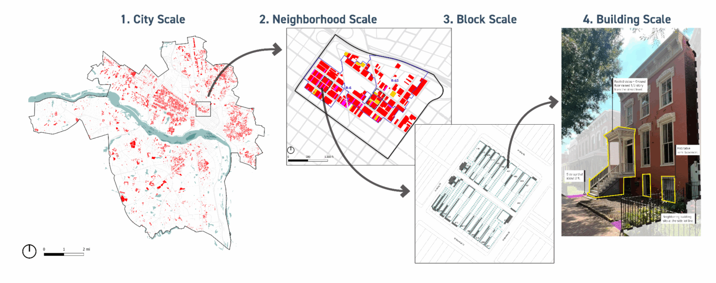
The analysis was done across different scales, by looking at patterns at the city, neighborhood, block, and building scales. A city-wide analysis of some general zoning metrics helped identify and select representative areas with a high number of nonconformities. The neighborhood scale allowed for detailing other form metrics, such as lot width, and analyzing the parcels’ distribution relative to zoning metrics. A finer grained study at the block scale, with a parcel-by-parcel visual survey using satellite, photographic, and historical data provided a clearer understanding of each lot’s building attached/detached condition (some Richmond zoning districts make distinctions between requirements for attached and detached buildings), refine the previous scale’s analysis, inspect the building’s character and frontage, and to analyze the conformity to the required setbacks. Finally, the building scale served to illustrate those character, frontage, and setback relationships, and to identify basic architectural patterns that create a cohesive urban fabric.