South Portland Climate Resilience Zoning Project
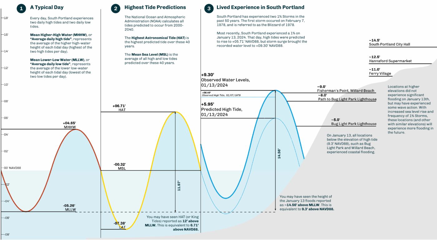
Utile is working with the City of South Portland, Maine to update the City’s land use code to adapt to and better manage three climate risk factors: coastal flooding, stormwater management, and high heat. Coming just over a year after the community’s lived experience of the historically high floodwaters in January of 2024, this climate resilience zoning effort is all about calibrating to balance private-sector investment in resilience with the community’s unique physical fabric and development goals.
As coastal communities face increasing risk from sea level rise and storm surge, South Portland is taking proactive steps to align local zoning with long-term climate resilience. This project lays the groundwork for a zoning framework that protects public infrastructure, supports private investment, and adapts the built environment to future conditions.
To support this work, Utile developed clear and accessible materials to communicate the science behind two sea level rise scenarios and two hydrodynamic models projecting coastal storm surge and tidal flooding. These resources were used in a series of public open houses and deliberative forums designed to make technical concepts accessible and foster meaningful community participation in planning decisions.
The engagement process focused on how risk is assessed across land use categories and how resilience requirements could be tailored through zoning to match varying levels of exposure and sensitivity. Participants explored trade-offs in regulating for long-term resilience while allowing for flexibility in new construction infill and adaptive reuse, particularly in South Portland’s downtown and waterfront communities.
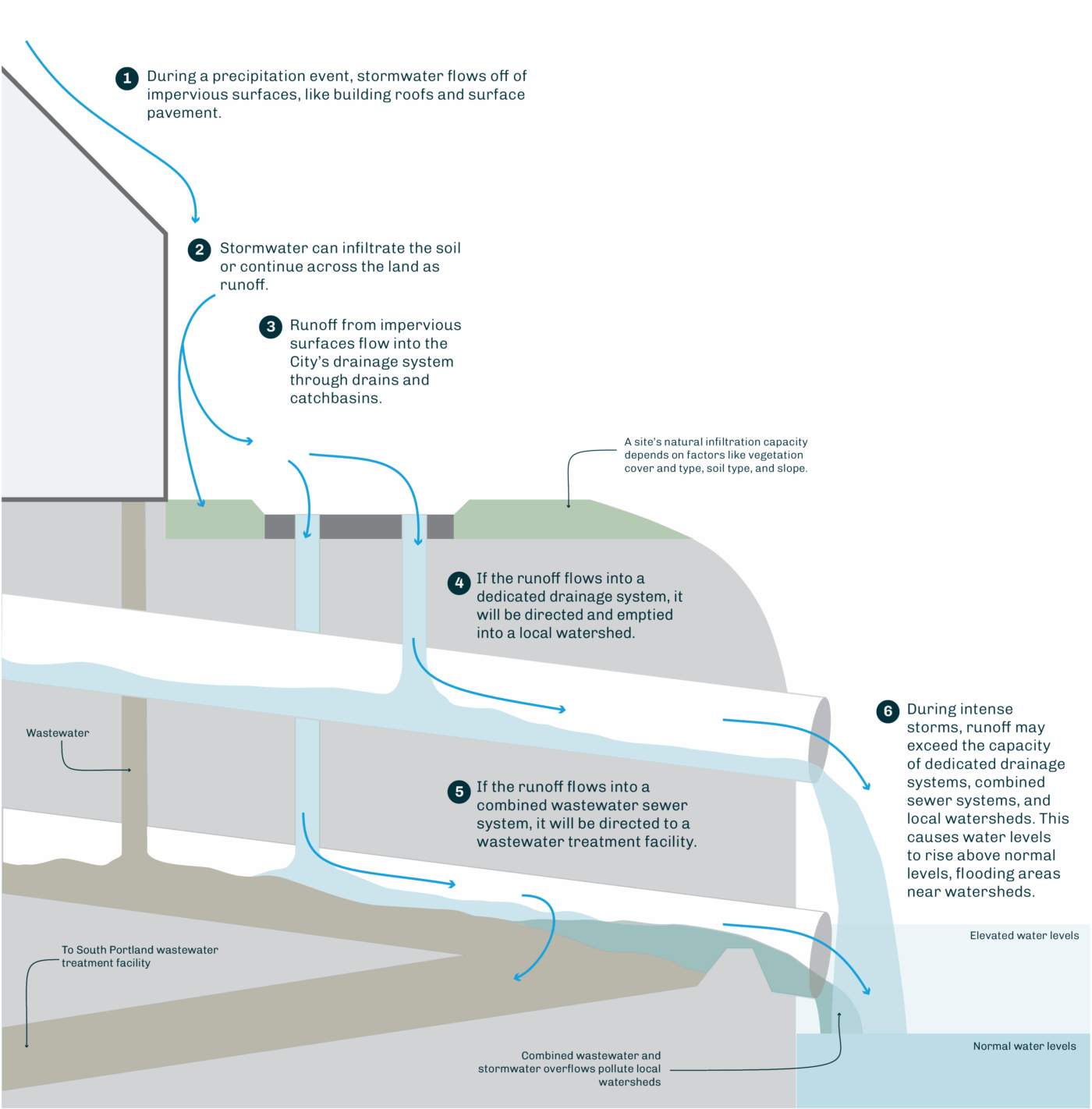
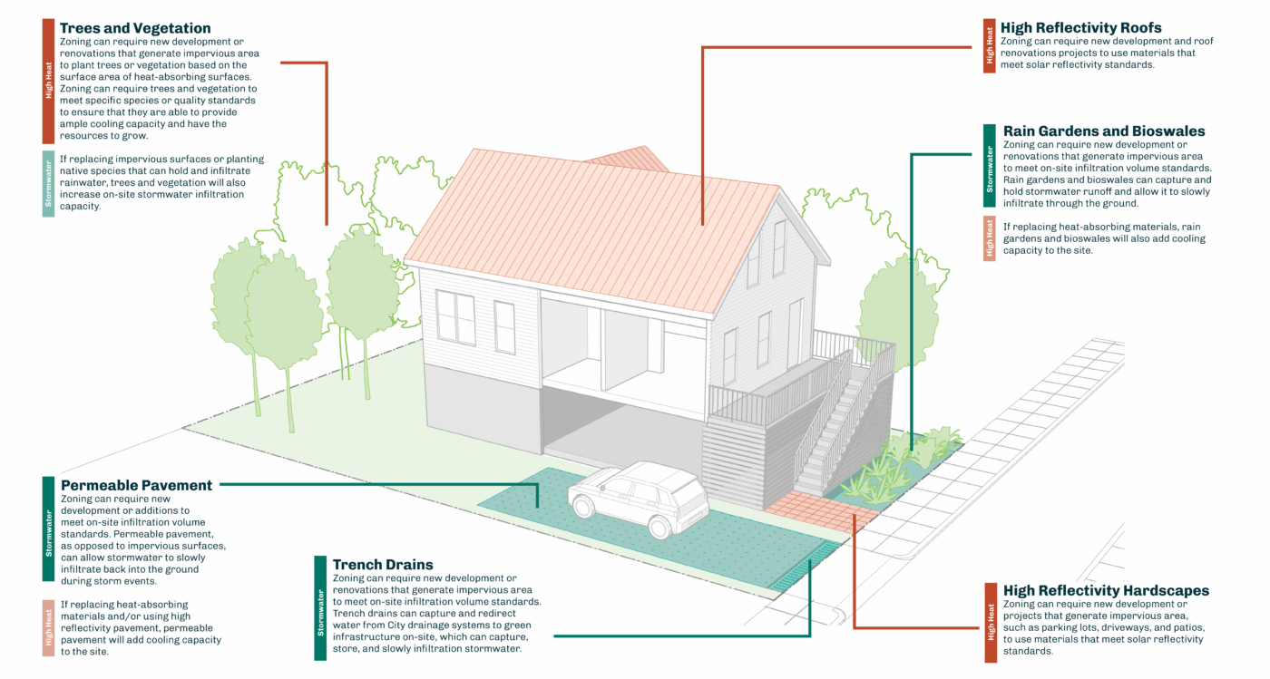
The draft approach includes a proposed coastal flood resilience overlay district supported by citywide updates to site plan review and stormwater regulations. These updates aim to increase on-site stormwater retention through low-impact development and green infrastructure, and to mitigate high heat impacts through updated tree planting standards and minimum Solar Reflectance Index (SRI) ratings. Together, these strategies form a flexible but forward-looking toolkit to help South Portland manage risk, guide future development, and build climate resilience into the local land use policy.