Atlanta Zoning Existing Pattern Analysis
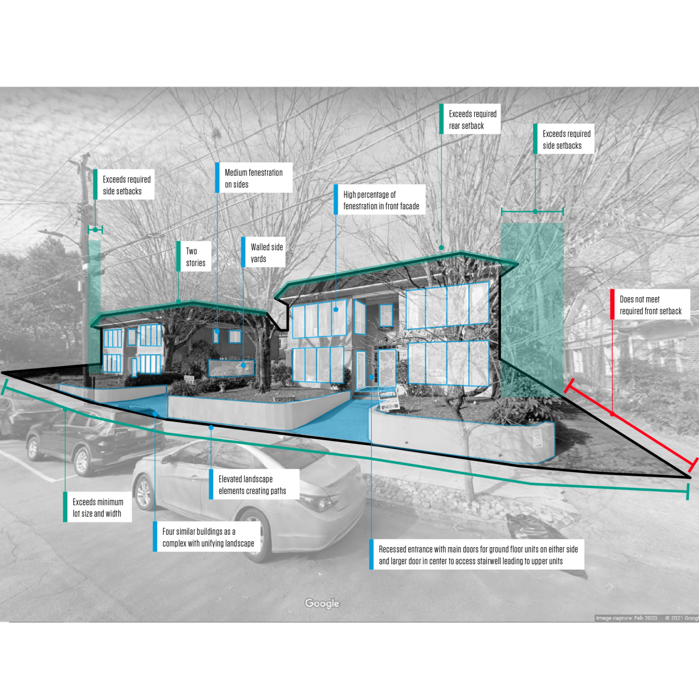
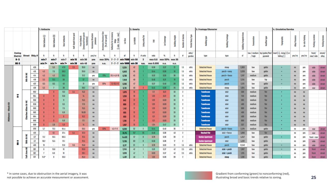
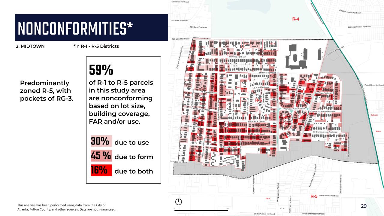
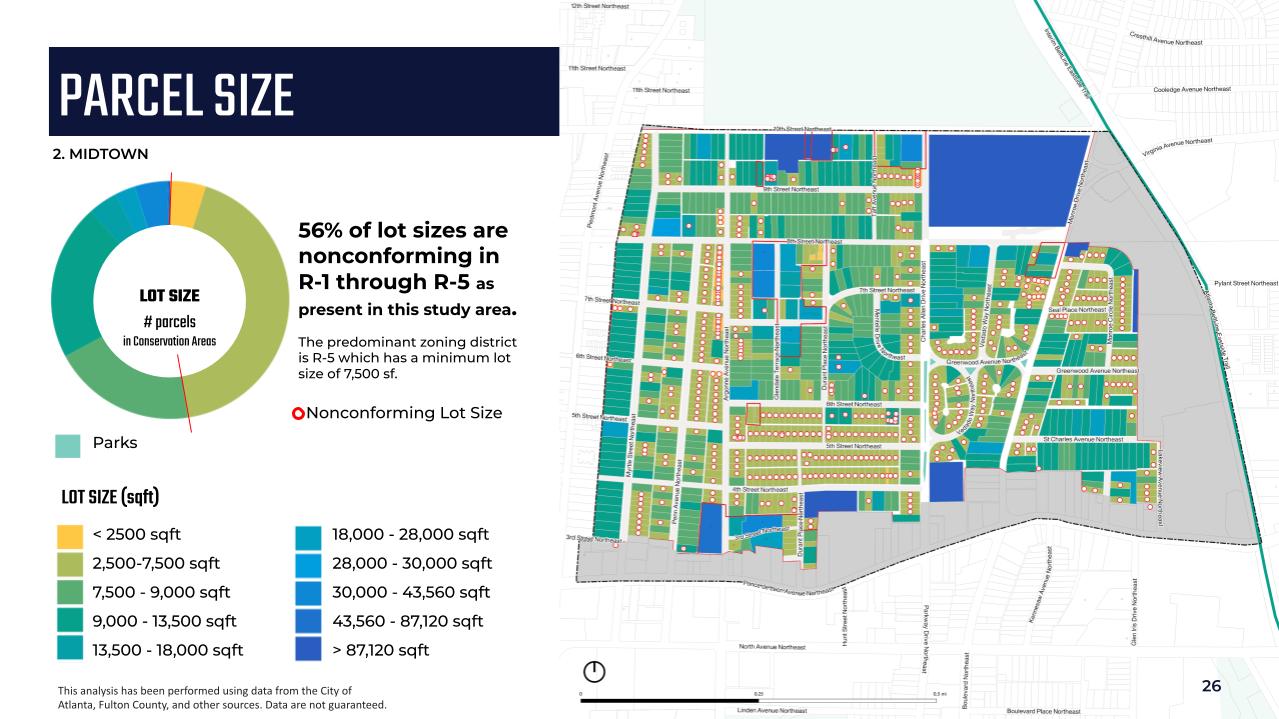
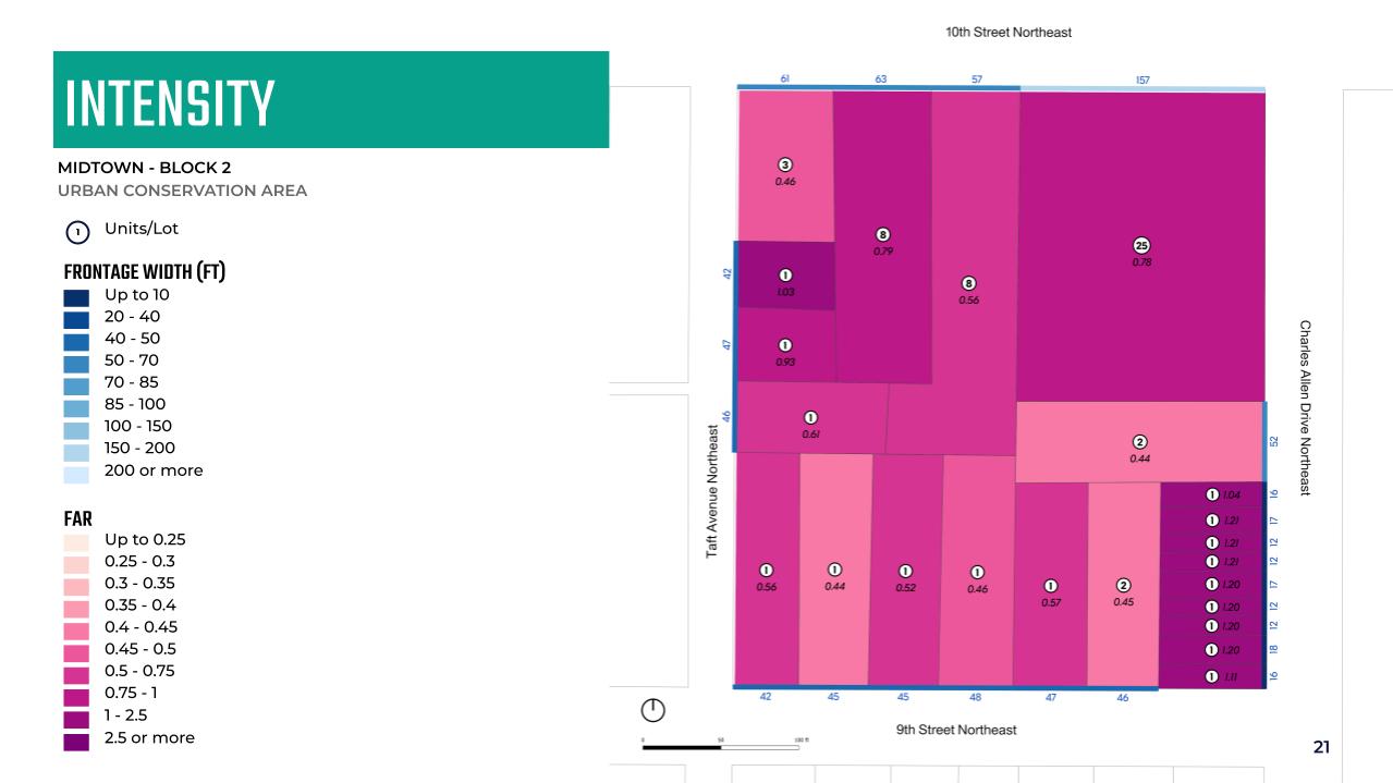
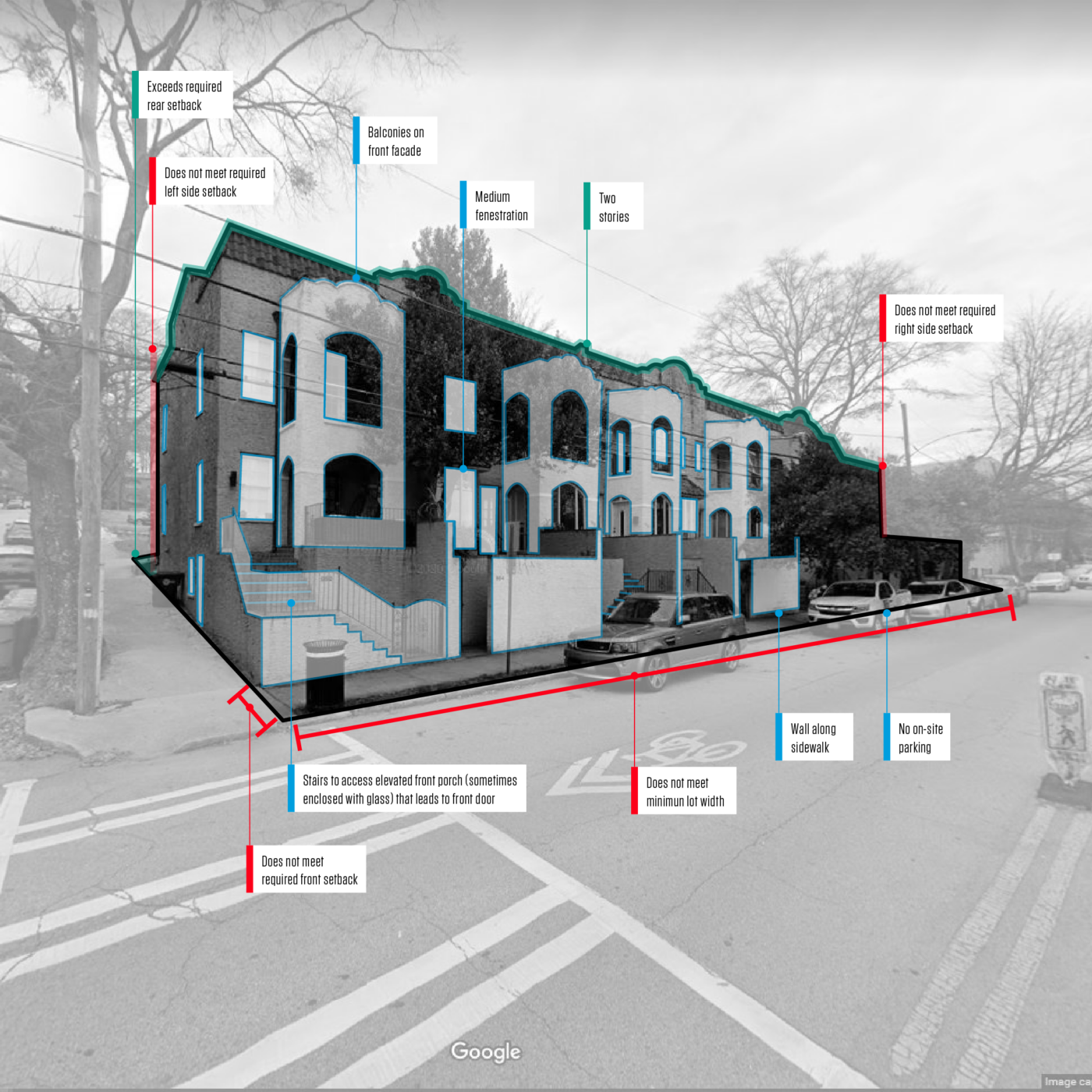
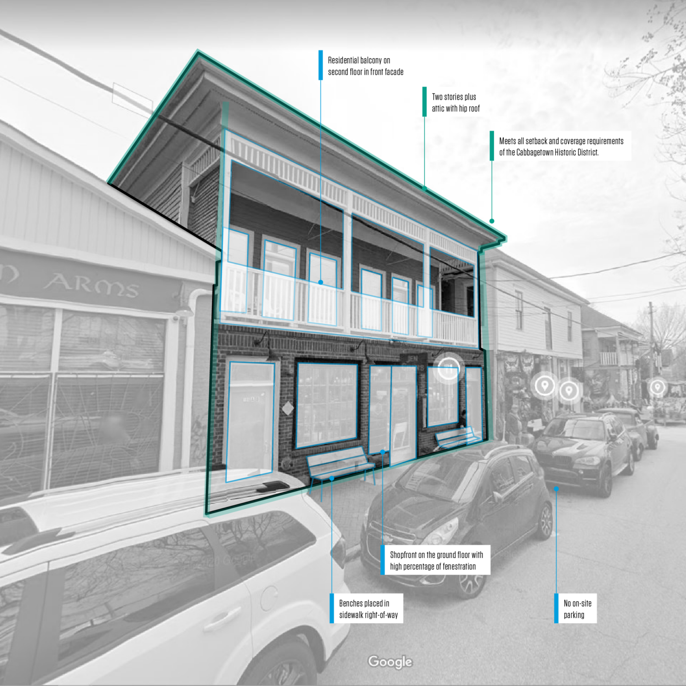
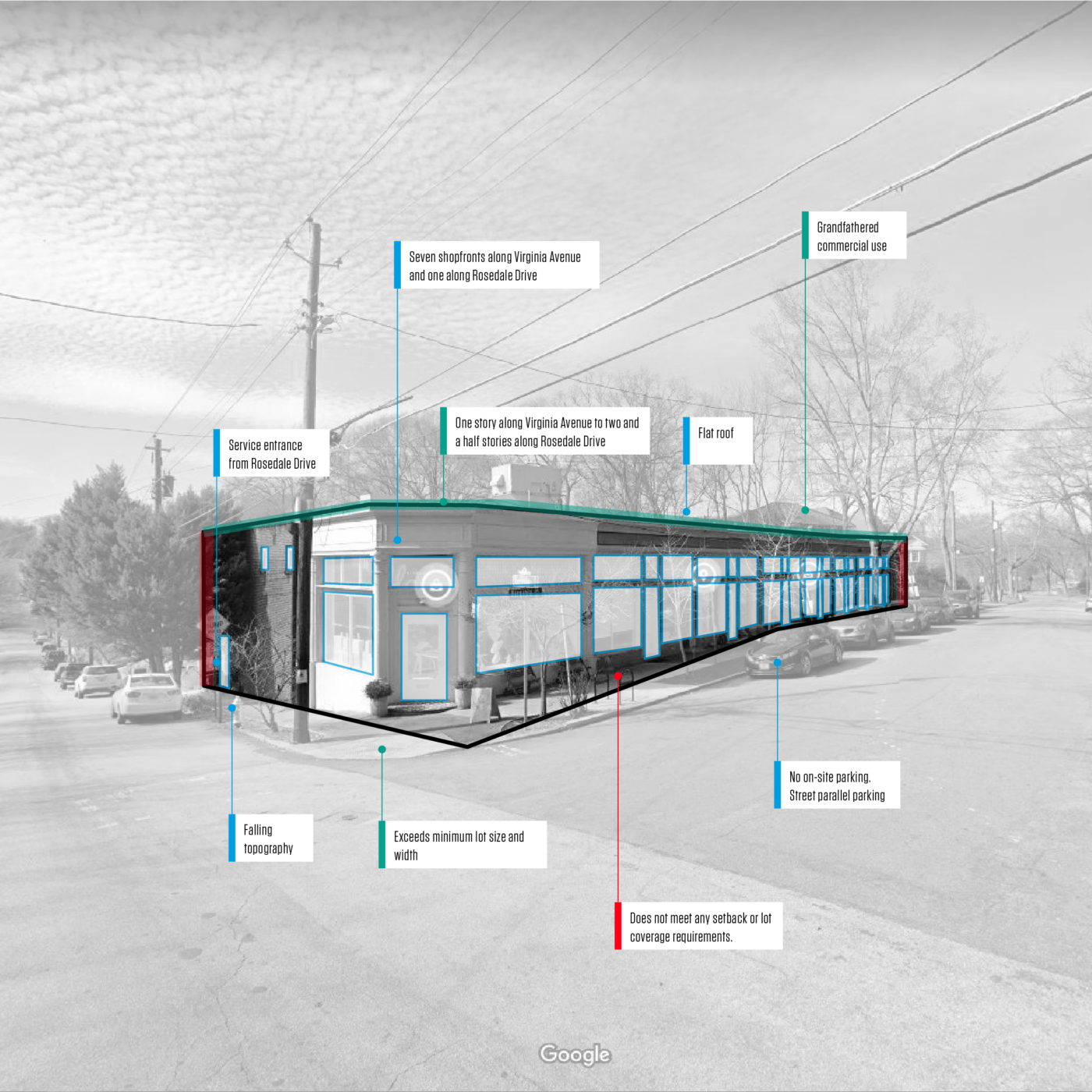
As part of their citywide zoning update process, Utile performed an existing conditions analysis for the City of Atlanta. Existing conditions were analyzed relative to current zoning standards across several metrics: setbacks, lot size, building coverage, building height, floor-area-ratio, living units per lot, and lot frontage width.
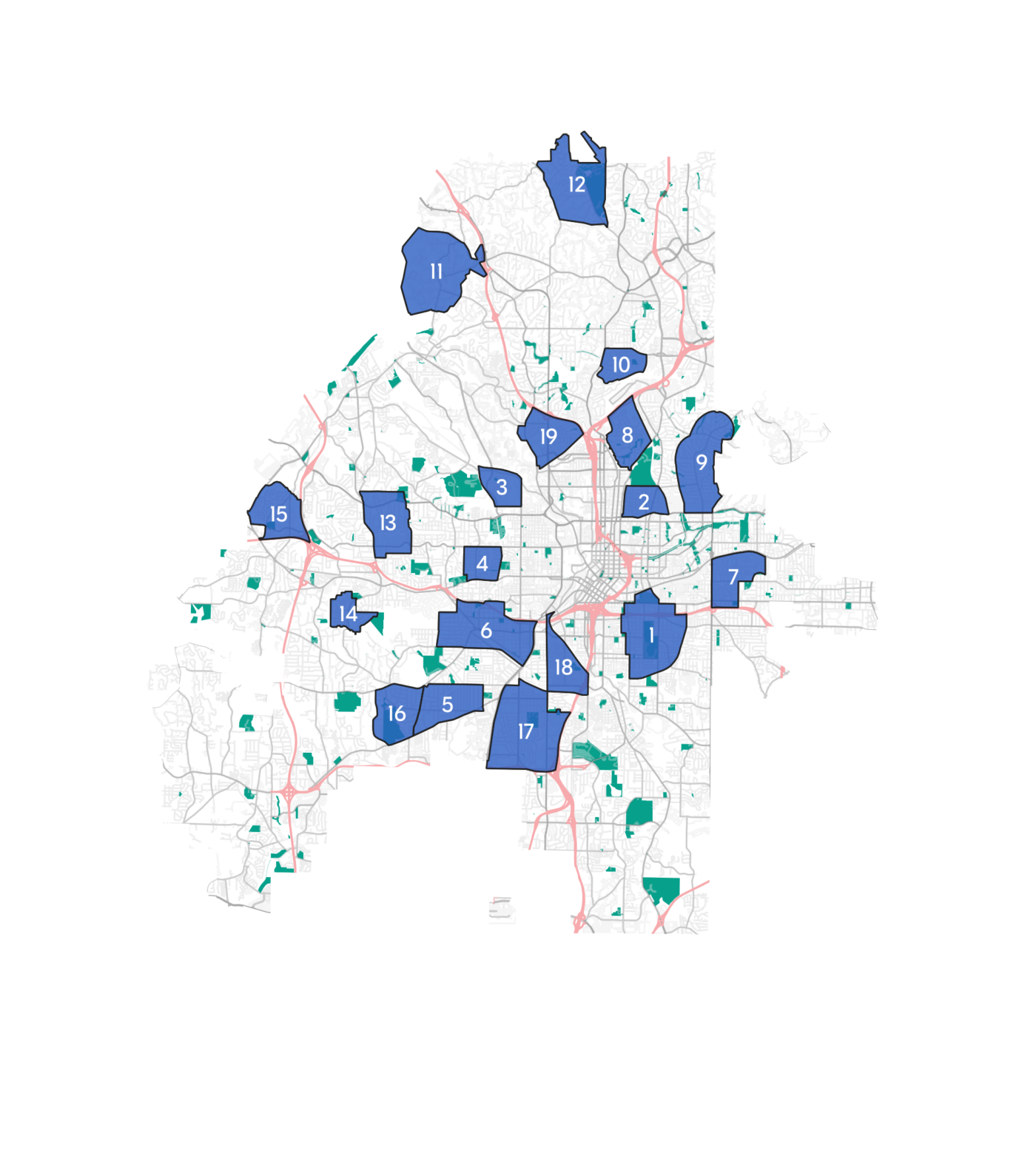
Utile assessed nonconformities or disconnects between the current zoning and existing conditions through a nested scale method, by analyzing representative areas at the city, neighborhood and block scales. Starting with selected representative neighborhoods with a high number of nonconformities, commonalities and differences were tagged in relation to use, parcel size, units per parcel, nonconformities and building type patterns. These neighborhood scale investigations were followed by a finer grained study of representative blocks to get a closer understanding of density, setbacks, circulation and other metrics as they relate to land use controls.
The base method for this analysis is what planners call “Spatial Data Analysis using a Geographic Information System,” which consists of mapping data into geo-referenced images, allowing the visual analysis of this data through various layers of information at varying scales.
The data is translated into legible spatial graphics and infographics permitting the consultant team to compare and contrast different areas’ relationship between existing conditions and current zoning. The main objective of this work was to inform new land use regulations that will be more reflective of existing patterns and to permit growth that is compatible with underlying neighborhood character.
View the reports at the links below:
