As a subconsultant to HR&A, Utile completed a comprehensive office-conversion feasibility analysis of downtown Boston, focused primarily on residential (and hotel) conversions. Completed in early 2023, the study informed HR&A’s policy recommendations to the Boston Planning and Development Agency (BPDA), and in July 2023, the City implemented a tax abatement incentive to promote office-to-residential conversions. Utilizing this policy incentive, several properties have already applied and been approved for said conversions.
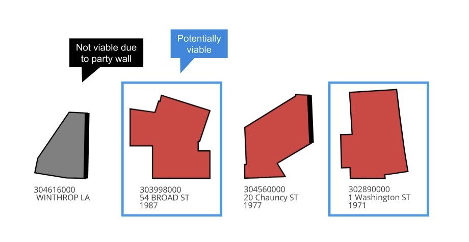
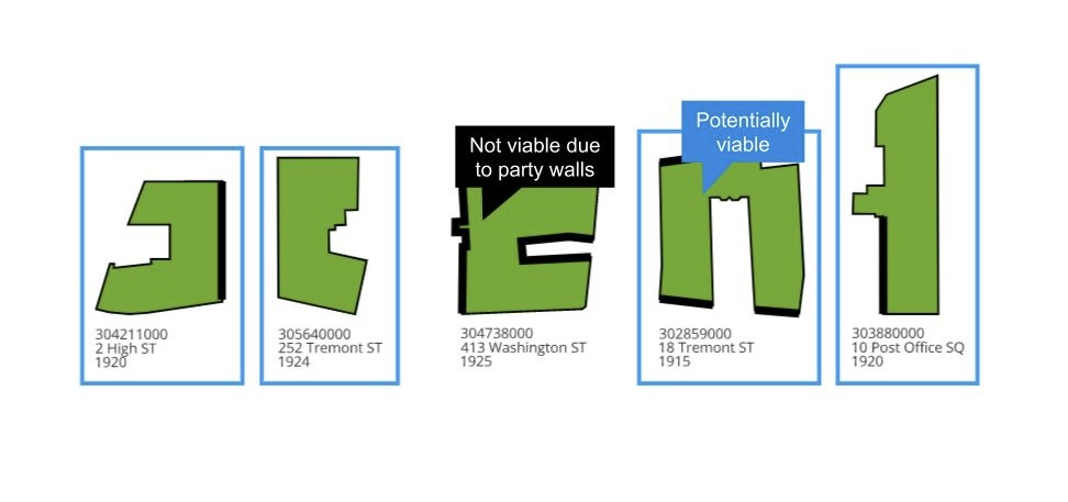
Utile’s conversion feasibility analysis is predicated on examining the width of existing buildings (as they relate to viable residential typologies) and access to window walls (via identifying the presence of party walls).
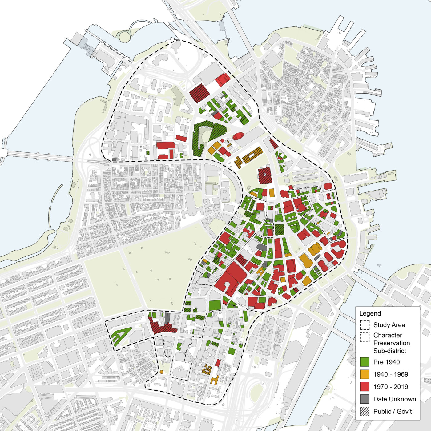
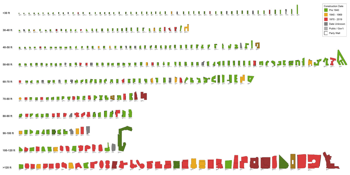
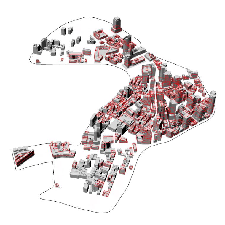
In terms of methodology, Utile used GIS-based tax assessor’s data to identify all office buildings in the downtown study area. A 3D model of downtown was created and planimetric cuts of all office buildings were taken at roughly 40ft above grade to create a map showing only typical floor plates, which were then laid out in a matrix to study their widths and adjacency to party walls, if any. Buildings deemed viable for residential conversion were noted and new maps were generated that filtered for only said buildings.
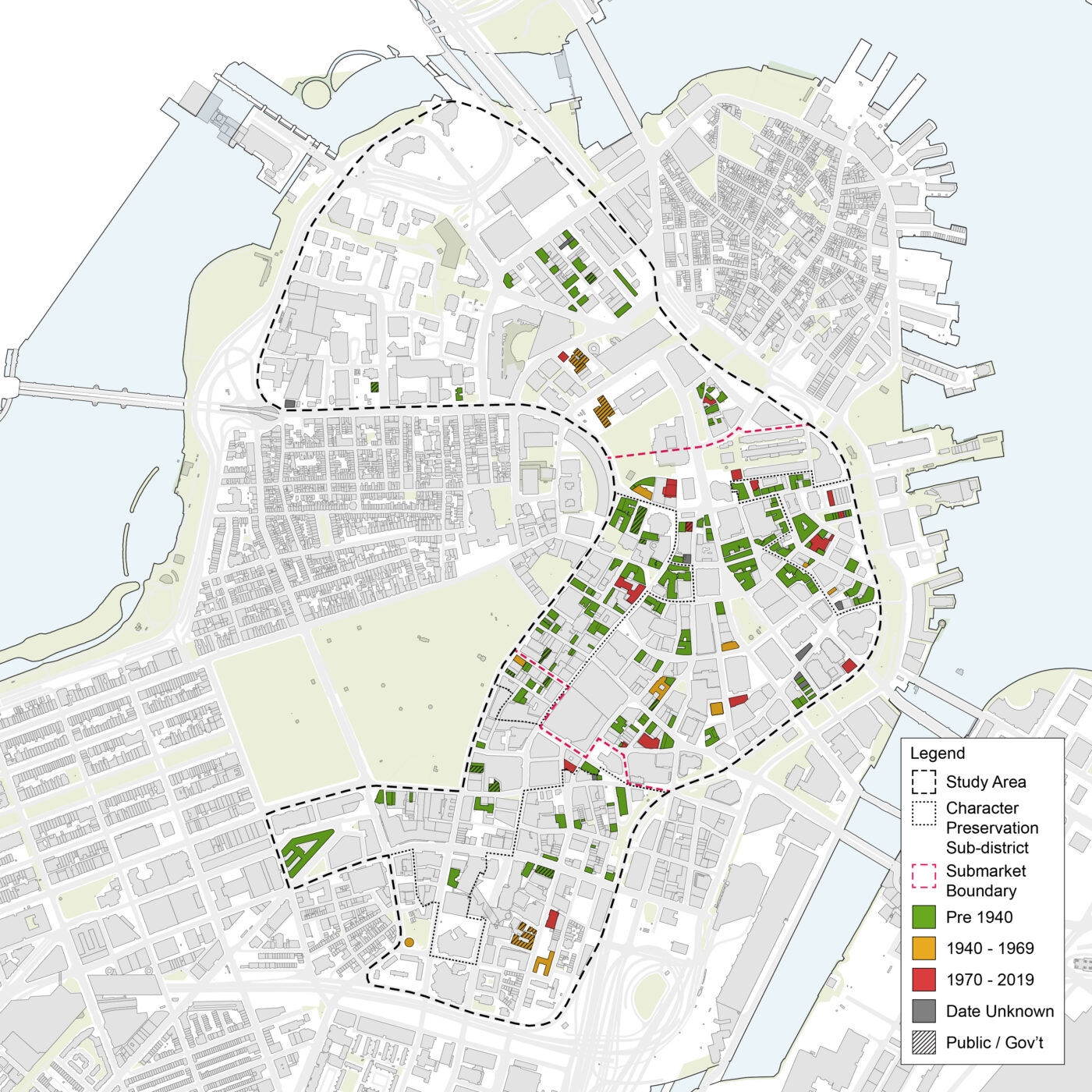
A map showing all office buildings in downtown Boston sorted by age. This map shows the correlation between age and building width, where pre-war office buildings tend be more narrow (less than 60ft) whereas more modern post-1970’s office buildings tend to have much wider floorplates (greater than 120ft).To examine the feasibility of downtown office buildings, the typical floorplates of said office buildings were laid out in a matrix sorted by width (e.g., below 30ft, between 30ft to 40ft, 40ft to 50ft, etc.). Party walls were also noted in thick perimeter lines to further inform conversion viability (or lack thereof).Potentially viable as a point-loaded tower (70-100 ft wide)
Potentially viable as a double-loaded bar (50-70 ft wide)
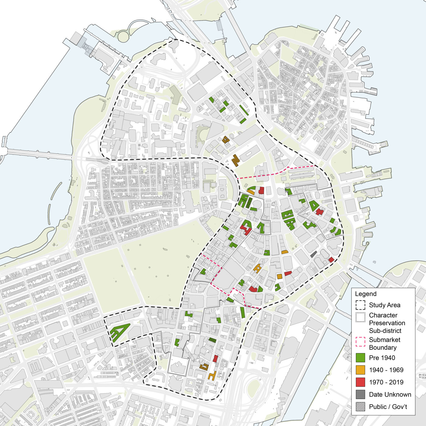
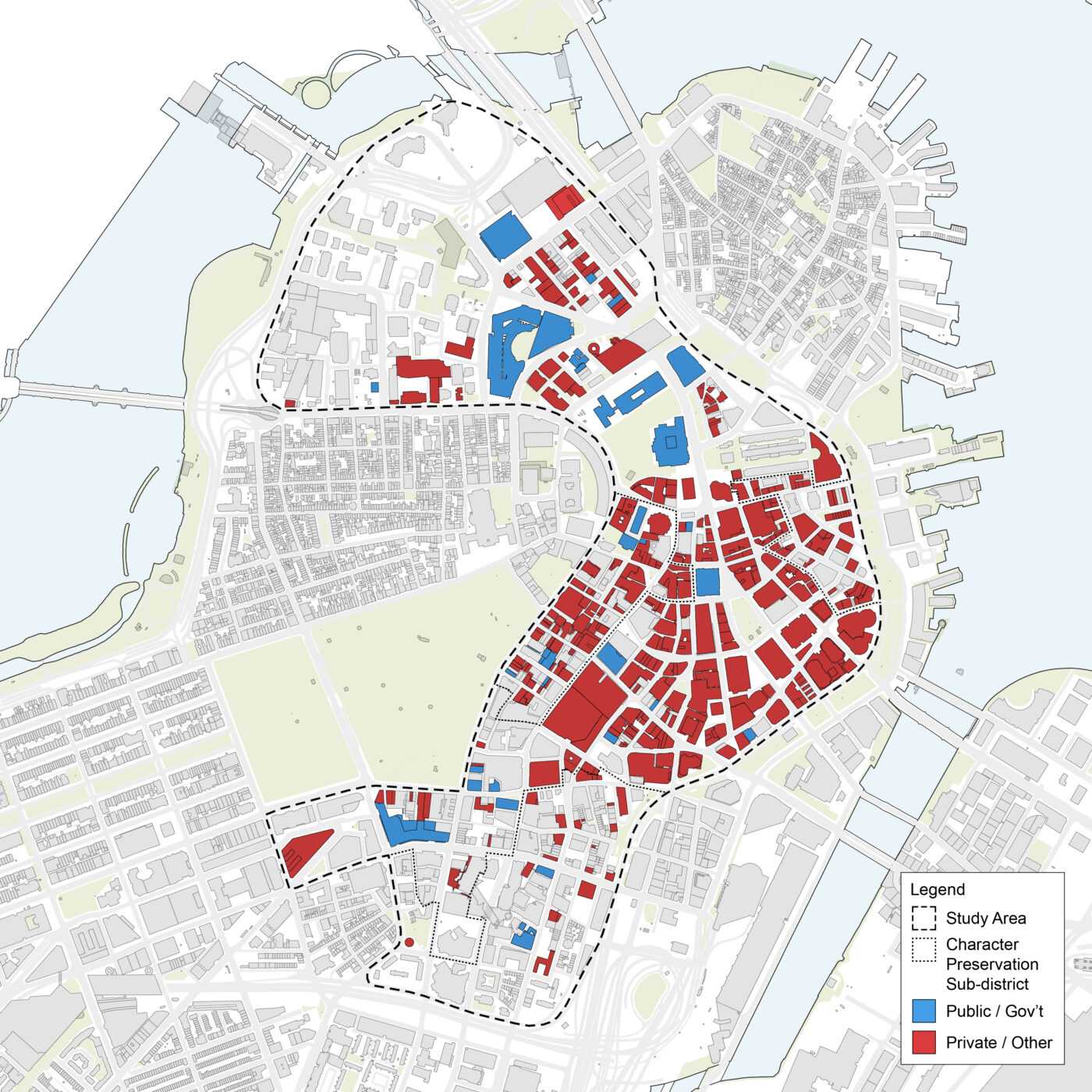
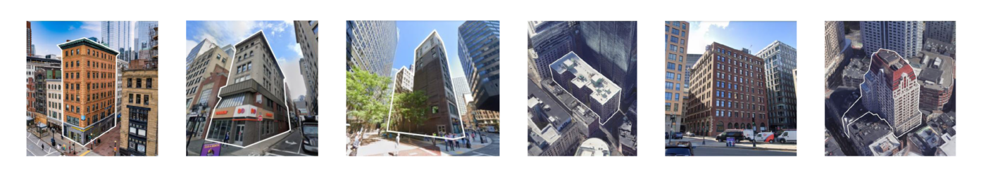
In order to visualize the width of the typical floorplates of downtown office buildings, a 3D model was downloaded and planimetric cuts were taken at roughly 40ft above grade to generate maps that represented only typical floorplates.A map showing all office buildings deemed viable for residential (and hotel) conversion based on their widths and adjacency to party walls.A map that further filters conversion-viable office buildings to only those that have at least 7,500 gsf floorplates, a minimum threshold deemed attractive for development.Using GIS tax assessor’s data, Utile identified all office buildings in the downtown study area. Public office building were identified in blue.A sample collection of buildings in downtown deemed viable for office-to-residential conversion as a part of this study.