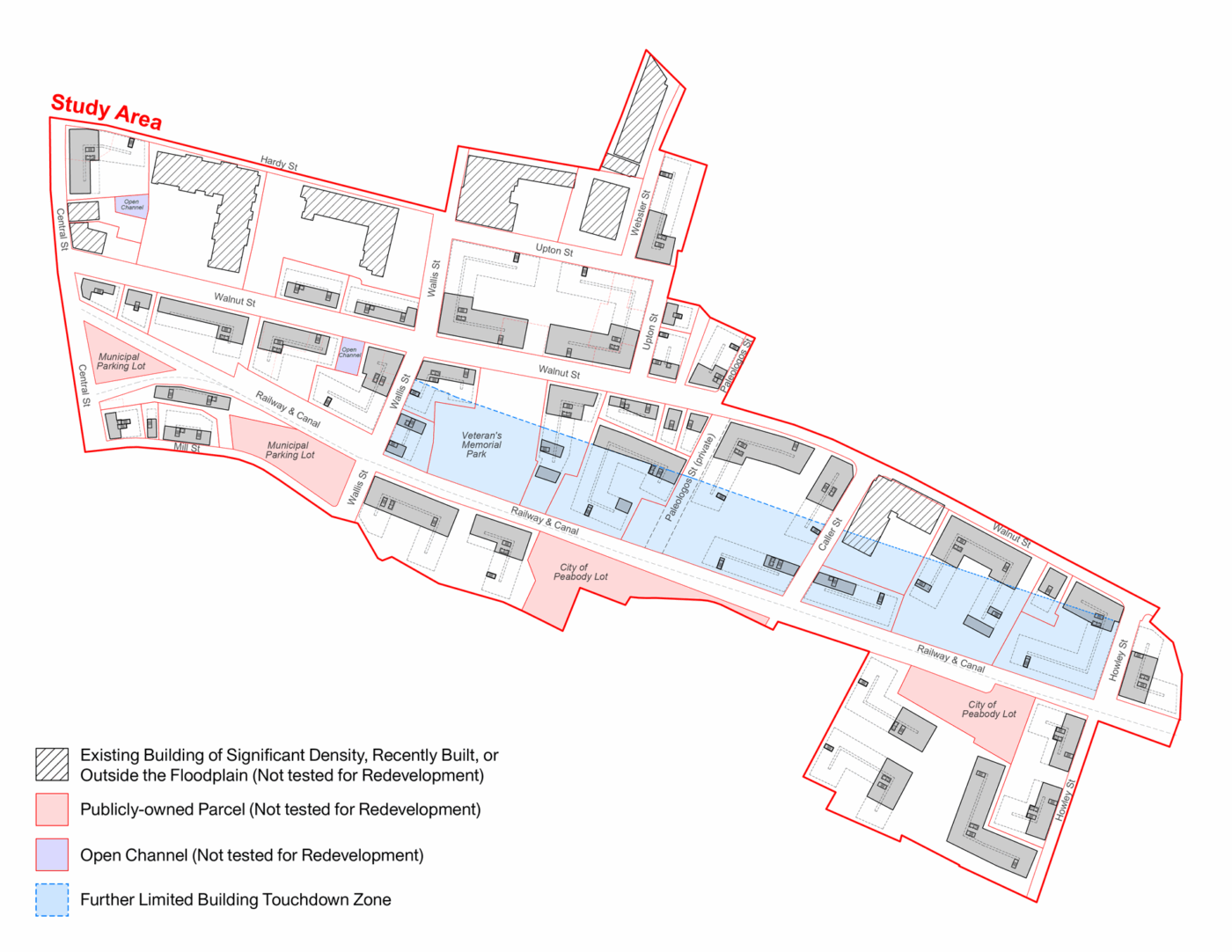
Peabody North River Resilient Zoning
Utile collaborated with Weston & Sampson to create a set of zoning recommendations that balance three goals for the North River study area: 1. Update existing zoning to improve redevelopment feasibility from a market perspective, 2. Enhance flood resilience for existing and future buildings in the floodplain, and 3. Promote a vibrant and walkable public realm, particularly along Walnut St.
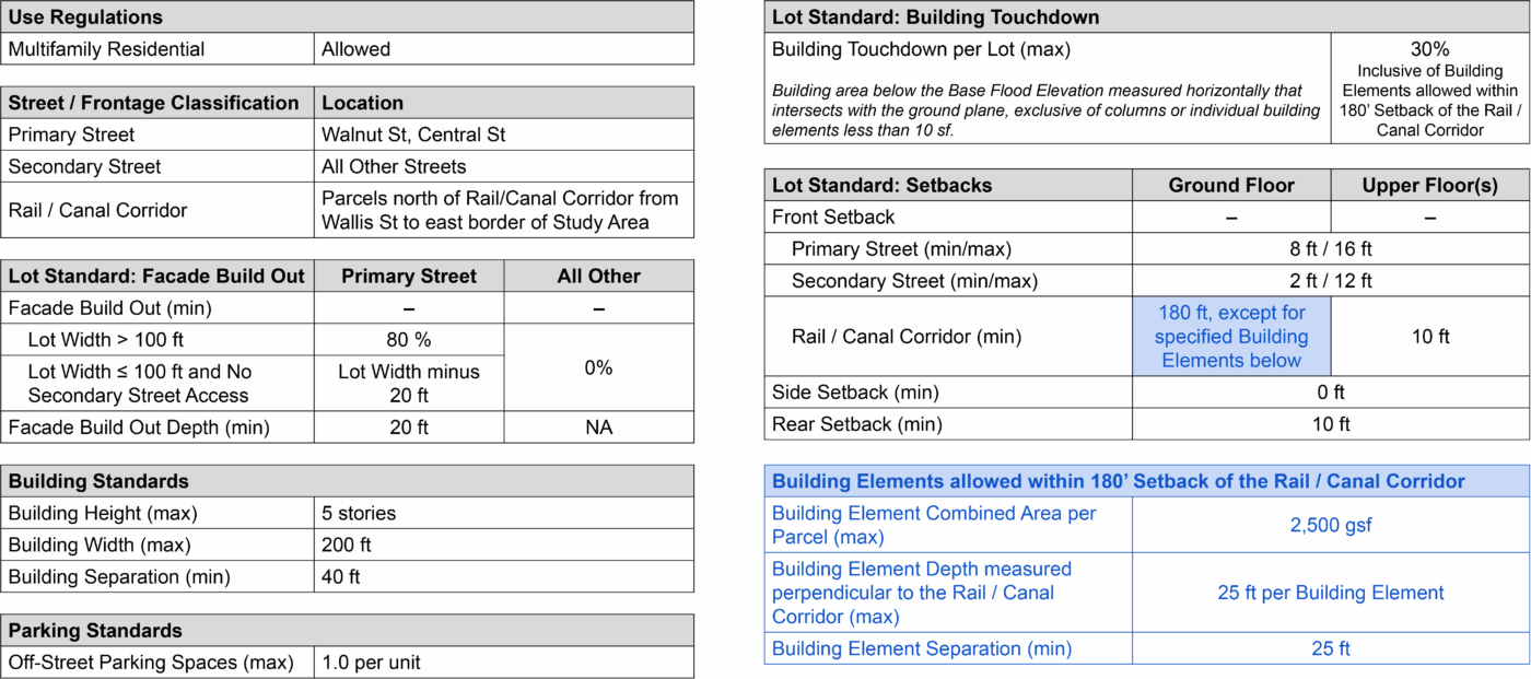
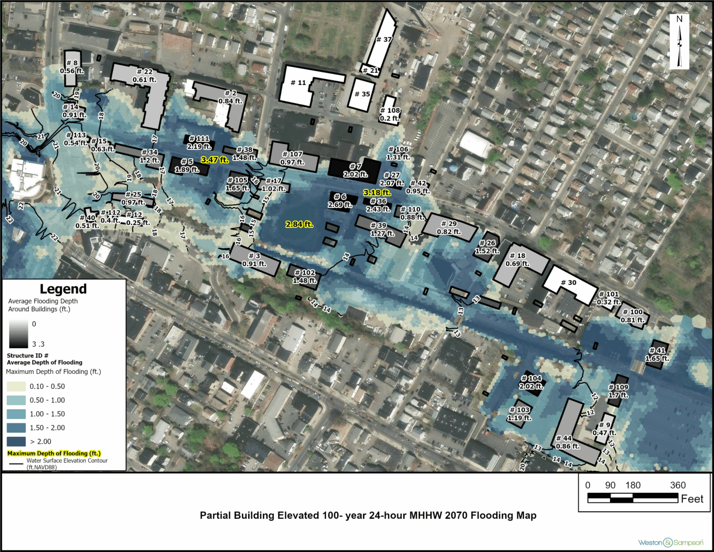
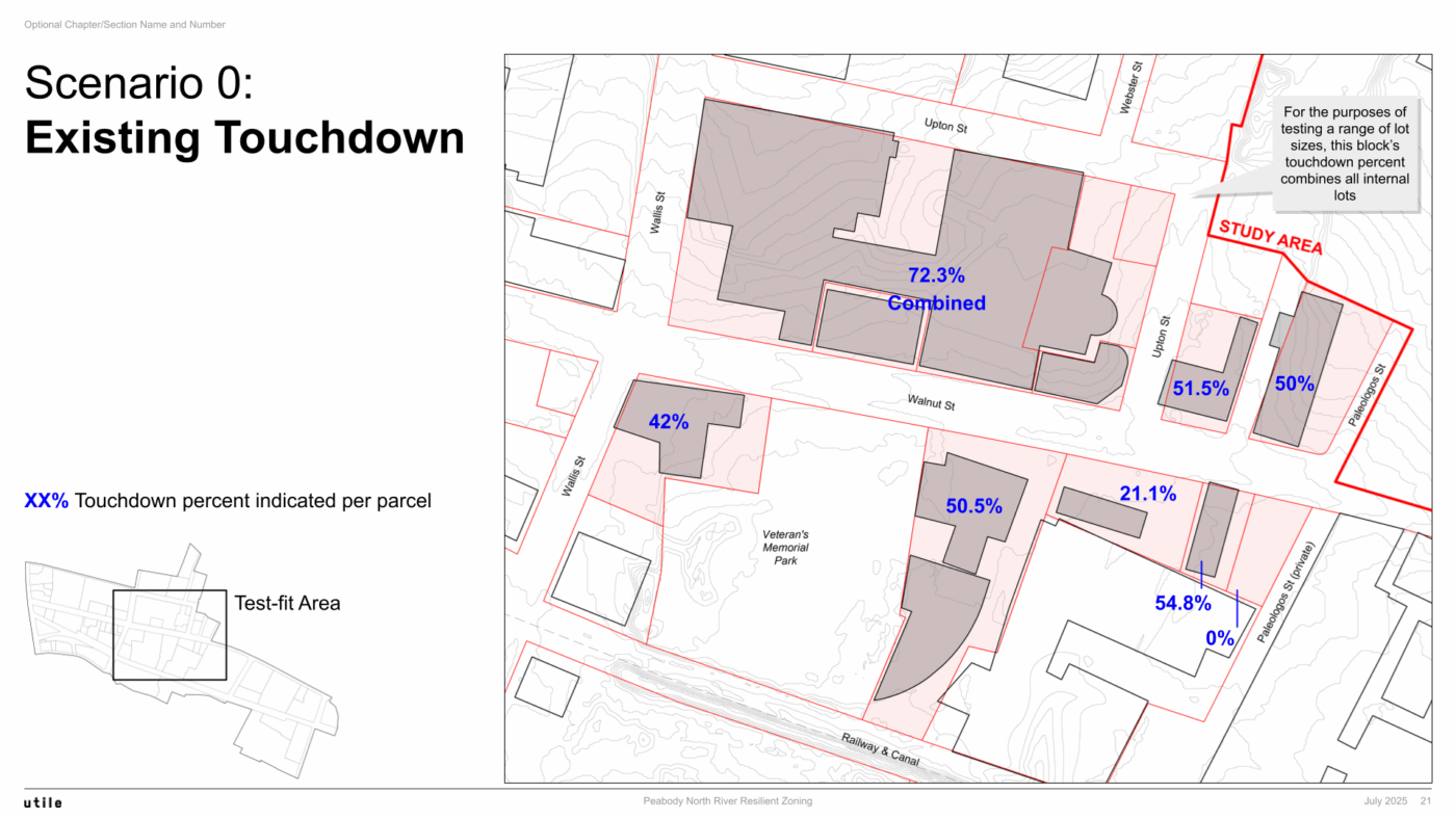
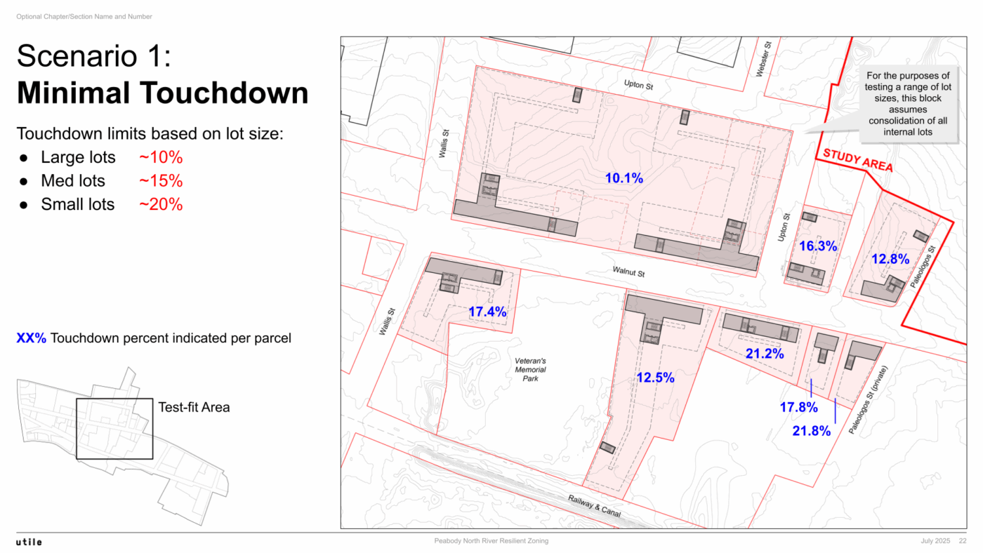
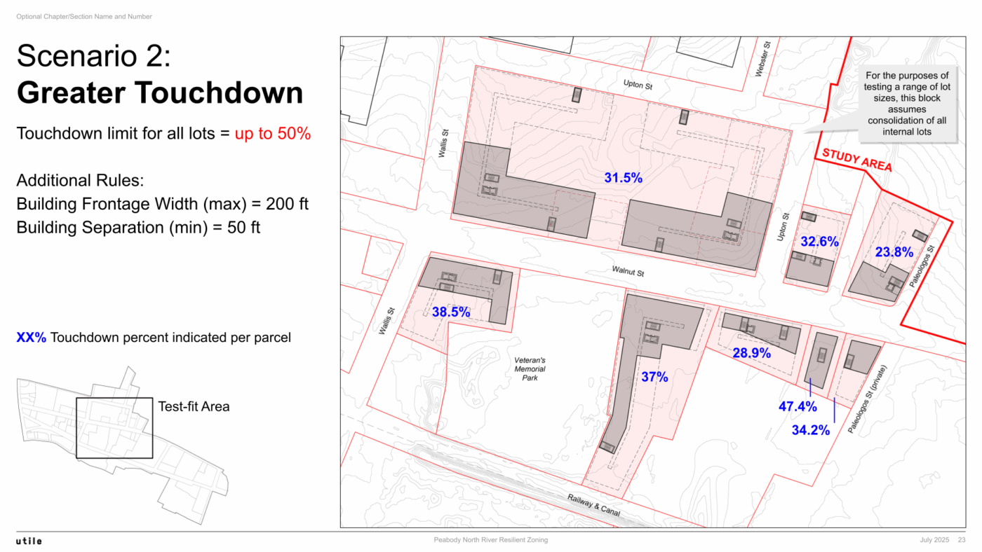
Weston & Sampson’s flood models showed that removing buildings from the floodplain (such as by elevating them) provides flood protection for both said buildings as well as other buildings in the study area. As such, to promote floodwater drainage and maximize flood protection for buildings, Utile created zoning recommendations that limit what can be called “Building Touchdown,” defined as building area below the Base Flood Elevation that intersects with the ground plane, exclusive of columns or small individual building elements. Test-fits and flood modeling show that a 30% limit on Building Touchdown balances maximizing flood protection and staging an active street edge along Walnut St, the main urban corridor in the study area.