Providence 6-10 Connector
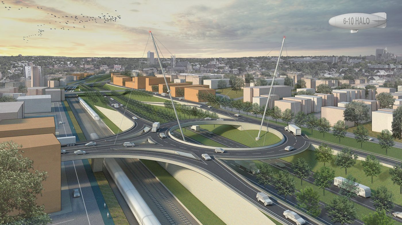
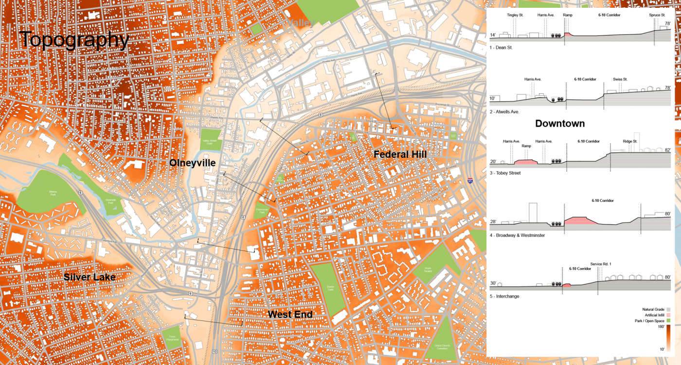
Working with the City of Providence, Utile and Nelson\Nygaard helped to reimagine the deteriorating urban interchange and highway known as the 6-10 Connector, which runs between the Olneyville neighborhood and downtown Providence. The City/Utile team proposed an elevated rotary, dubbed the “halo”, and other strategies to slim the highway’s footprint and rationalize connections to and from surrounding neighborhoods. The new design aims to increase the amount of developable land, reconnect isolated neighborhoods, untangle traffic snarls, and improve connections for walking, biking, and transit.
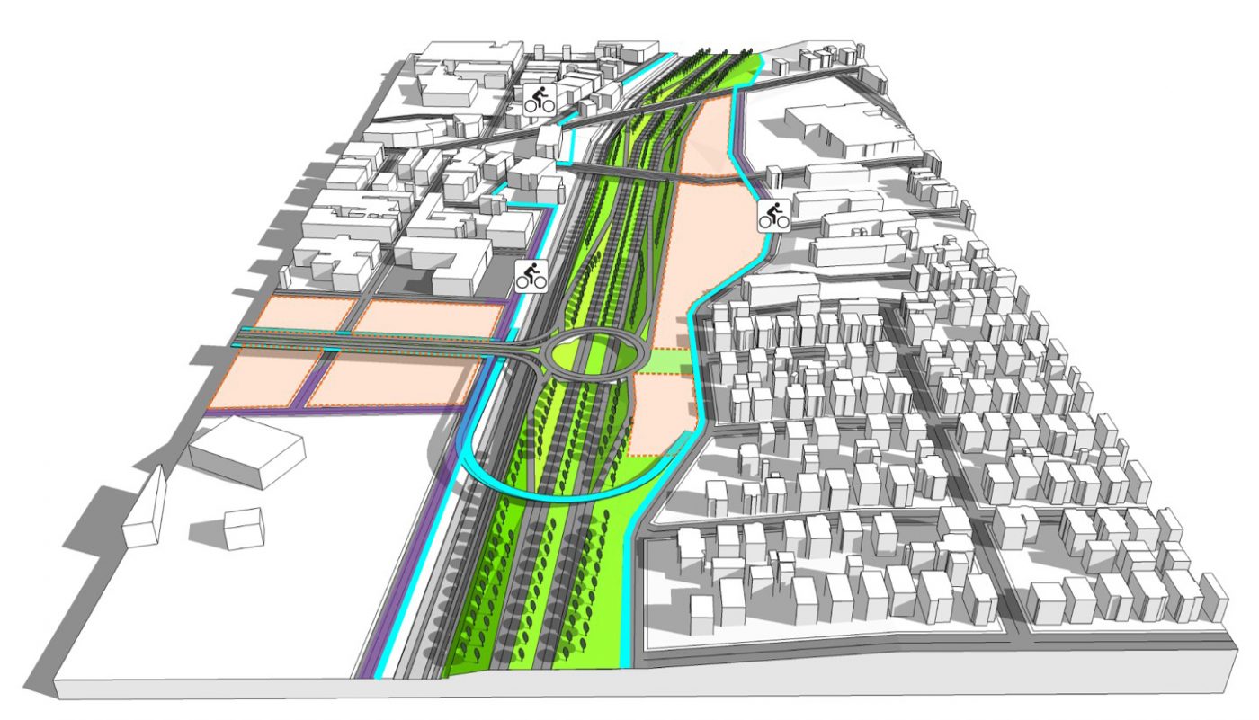
While the study was ongoing, the Rhode Island Department of Transportation announced that the project was being fast-tracked and the highway would be reconstructed as it currently exists. The City of Providence worked closely with RIDOT to improve the design, based on Utile’s analysis and extensive public input. The final design approved by RIDOT includes several key concepts surfaced through the Utile-led study, including converting the Tobey Street highway on-ramp to a city street, reclaiming land for open space or development, and adding a new bike and pedestrian path network that provides multiple new connections across the Amtrak corridor, dedicated bike facilities on three bridges across the 6-10 highway, and several miles of path along the edge of the West End neighborhood. The project was put out to bid by RIDOT in 2017 and construction is estimated to be complete in 2023.