Lynn South Harbor Implementation Plan
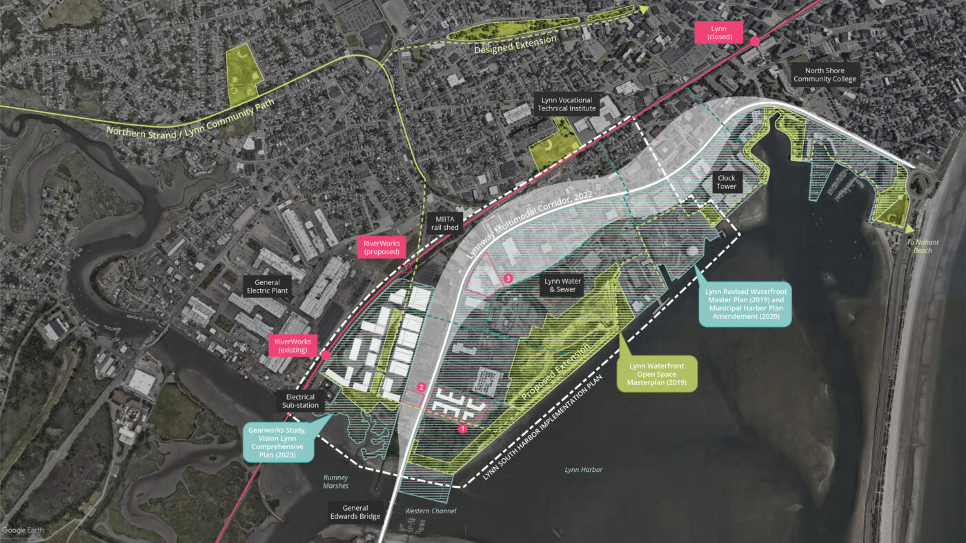
The Lynn South Harbor Implementation Plan is the culmination of years of disparate planning efforts conducted in and around the harbor. This includes projects such as the Waterfront Open Space Masterplan, Lynnway Multimodal Corridor Study, General Edwards Bridge Re-alignment, Northern Strand Extension, Revised Waterfront Masterplan, the Municipal Harbor Plan, and the Gearworks Study conducted by Utile as a part of Lynn’s first ever comprehensive plan.
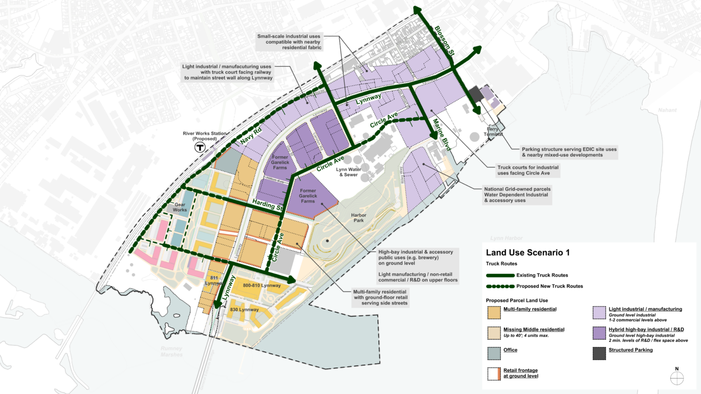
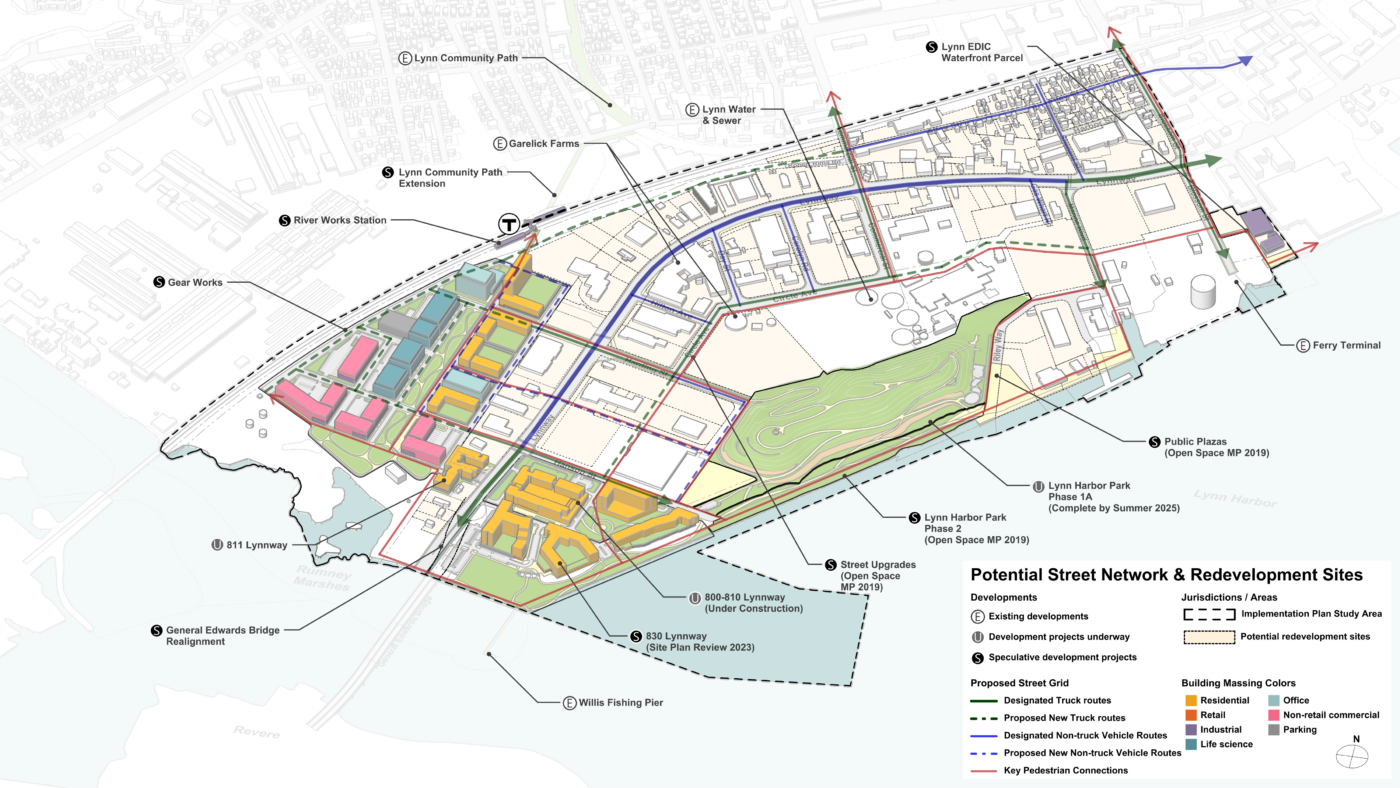
Utile is working alongside the City of Lynn to assess the many layers of efforts put in place, and combine them into a cohesive and progressive plan in alignment with the city’s vision of a mixed-use, transit-oriented district. The planning effort focuses on reconciling the provision of housing, jobs, and recreation, with expansion of the commercial tax base, mitigation of environmental degradation, and retention of existing city infrastructure and industrial uses.
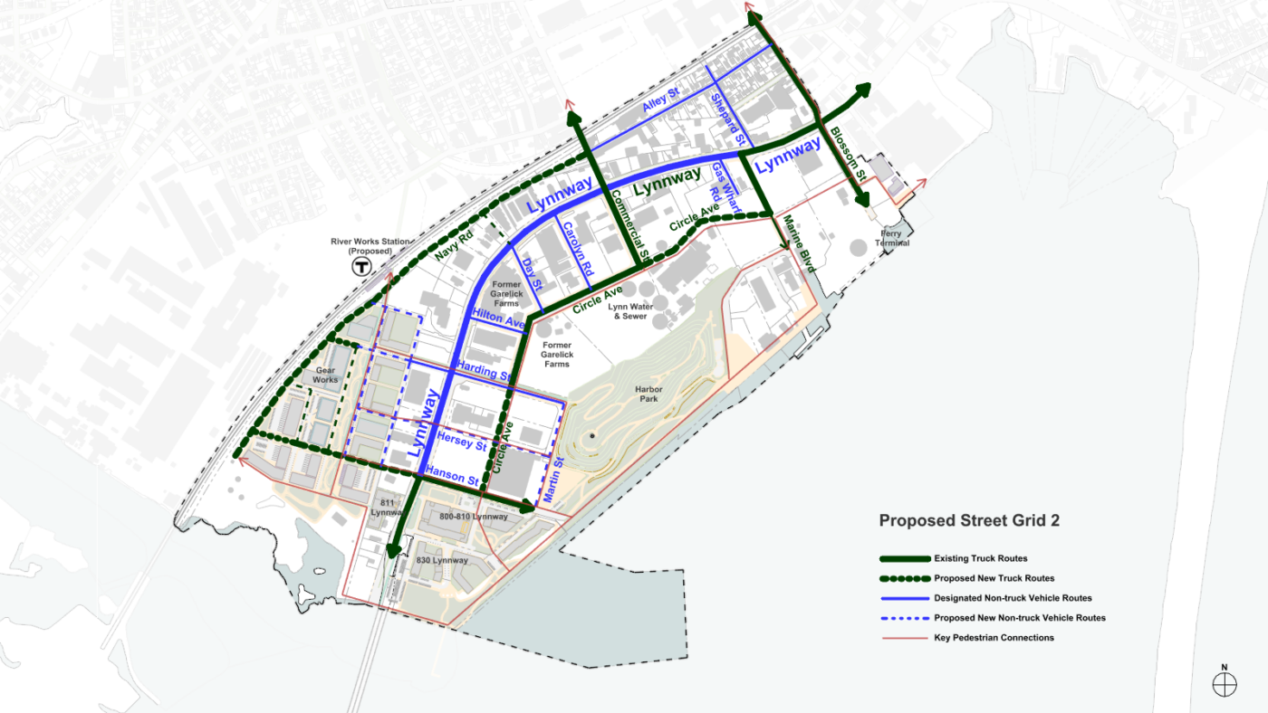
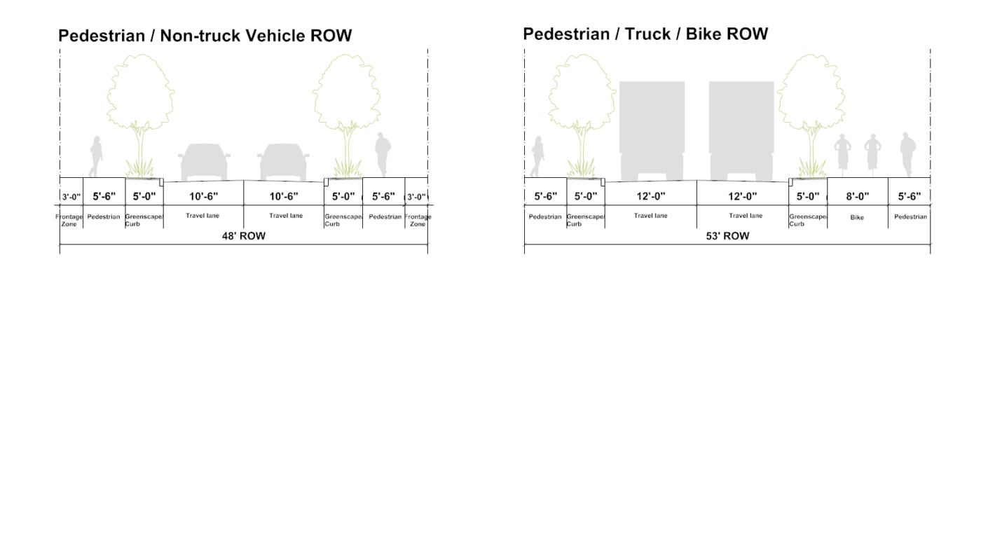
This complex patchwork of uses will be woven together by an improved Lynnway, providing a safer and friendlier entry into the city of Lynn, full of dynamic uses for residents and visitors, alike.